


views 1.4K

share


For many travellers, hiking can conjure up well-groomed trails, soft gradients, and wide jeep tracks winding through forests or open countryside. While that kind of hiking certainly exists in Cape Town, its most iconic trails offer something altogether more rugged, and often more technical, than many are used to.
Table Mountain and its surrounding ranges are not just backdrops to Cape Town’s skyline; they’re ancient, weather-beaten playgrounds that reveal landscapes unlike anywhere else. To Summit Table Mountain, the terrain is often steep, rocky, and exposed, and occasionally requires light scrambling with your hands. However, many trails in the Table Mountain National Park offer more comfortable hiking with scenery just as beautiful as the likes of Platteklip and Lion’s Head.
When approached with awareness and guidance from our Private Guides, hiking in Cape Town becomes one of the most memorable parts of our guests’ journey in the Cape.
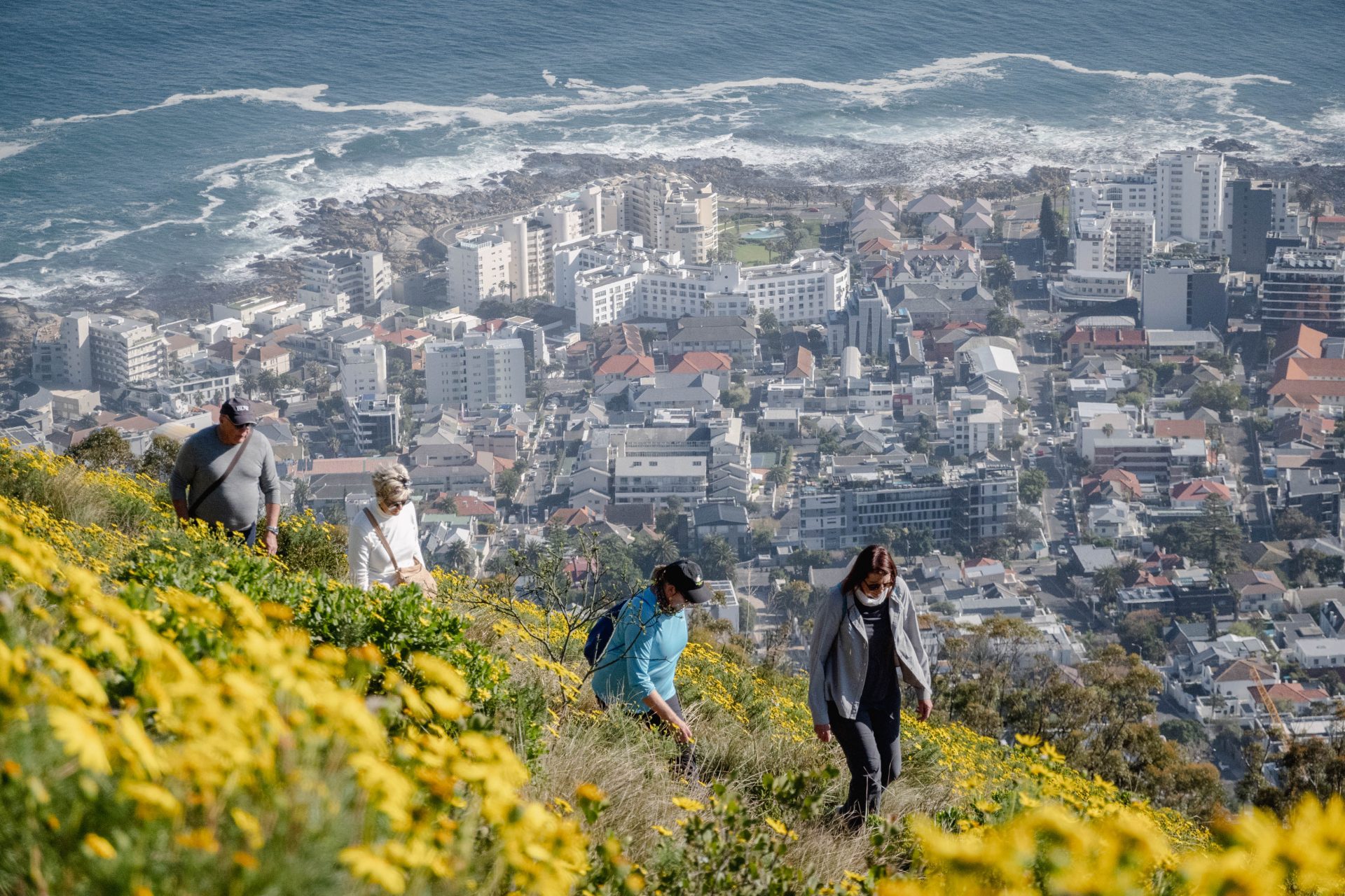
Platteklip Gorge
A seemingly never-ending winding climb, culminating in the ‘stairway to heaven’ that promises the most magnificent and well-earned views – Lee-Ann, Senior Travel Planner
The most requested route by guests, Platteklip, is often underestimated. Its clear, direct path straight up the front face of Table Mountain makes it a favourite among visitors, but the trail is a relentless climb of rock steps and switchbacks. While there is no scrambling, the elevation gain in such a short distance will test your legs and lungs.
Location: Front face of Table Mountain
Distance: ~2.5 km/1.5 miles each way
Elevation Gain: ~700m/2300ft
Difficulty: Moderate to strenuous
Technicality: Low, but steep
Pros: A direct route to the summit with panoramic views of the city.
Cons: Exposure to the sun and wind with little to no shade, and it is very busy in the peak summer season.
Flora & Fauna: Expect to see endemic fynbos, including proteas and ericas. Dassies (rock hyraxes) are common near the top, and sunbirds flit between flowering shrubs in warmer months.
India Venster
“Where fear meets freedom.” – Morné, Private Guide
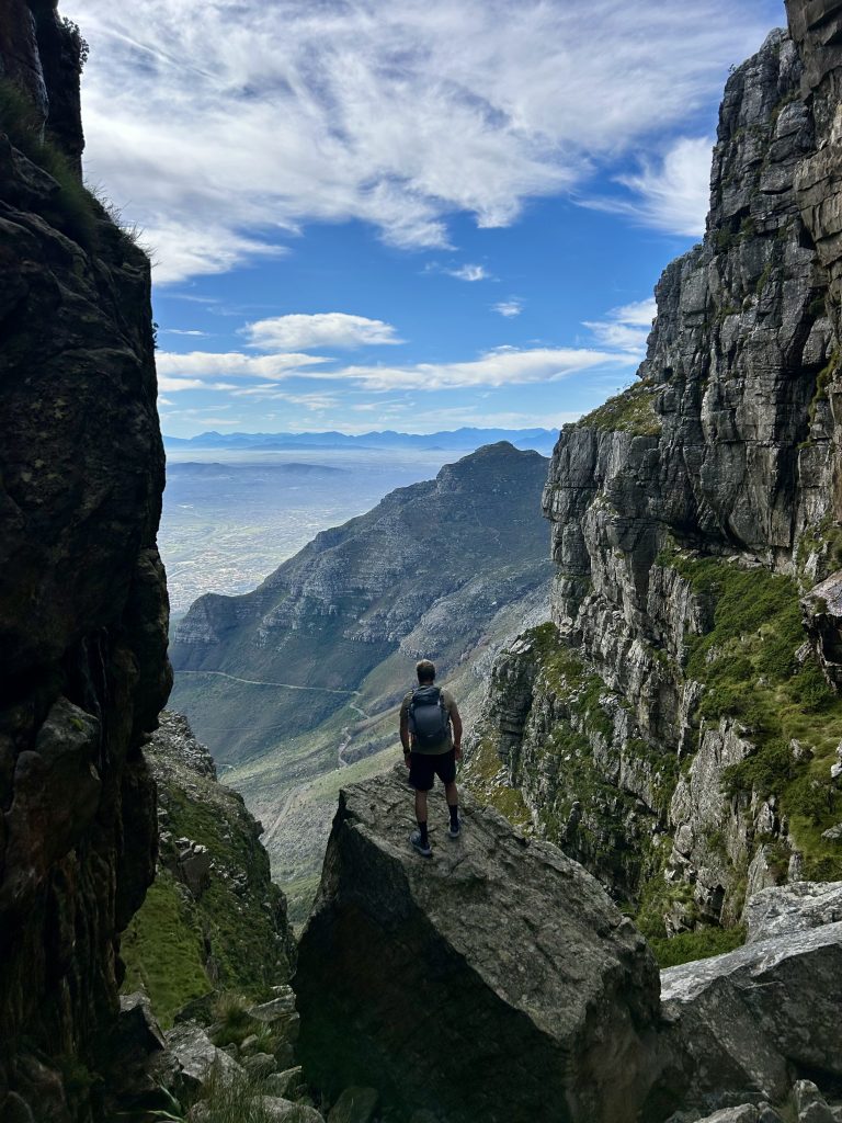
India Venster is not for the faint-hearted, but it’s easily one of the most thrilling hikes in Cape Town. Winding its way up beneath the cable car lines, this route hugs sheer cliffs and requires several short scrambles. While the hike is manageable for fit and sure-footed hikers, those with a fear of heights should consider another route.
Location: Front face of Table Mountain
Distance: ~3.5 km/2 miles
Elevation Gain: ~700m/2300ft
Difficulty: Challenging
Technicality: High, including scrambling and narrow ledges
Pros: Exciting route, incredible views and far less crowded than Platteklip.
Cons: Technical terrain that can be dangerous in wet weather.
Flora & Fauna: Keep an eye out for sunbirds, lizards basking on rocks, and even peregrine falcons circling above the cliffs.
Kasteelspoort
“A beautiful, quiet corridor leading up to picture-perfect views.” – Jacqui, Private Guide
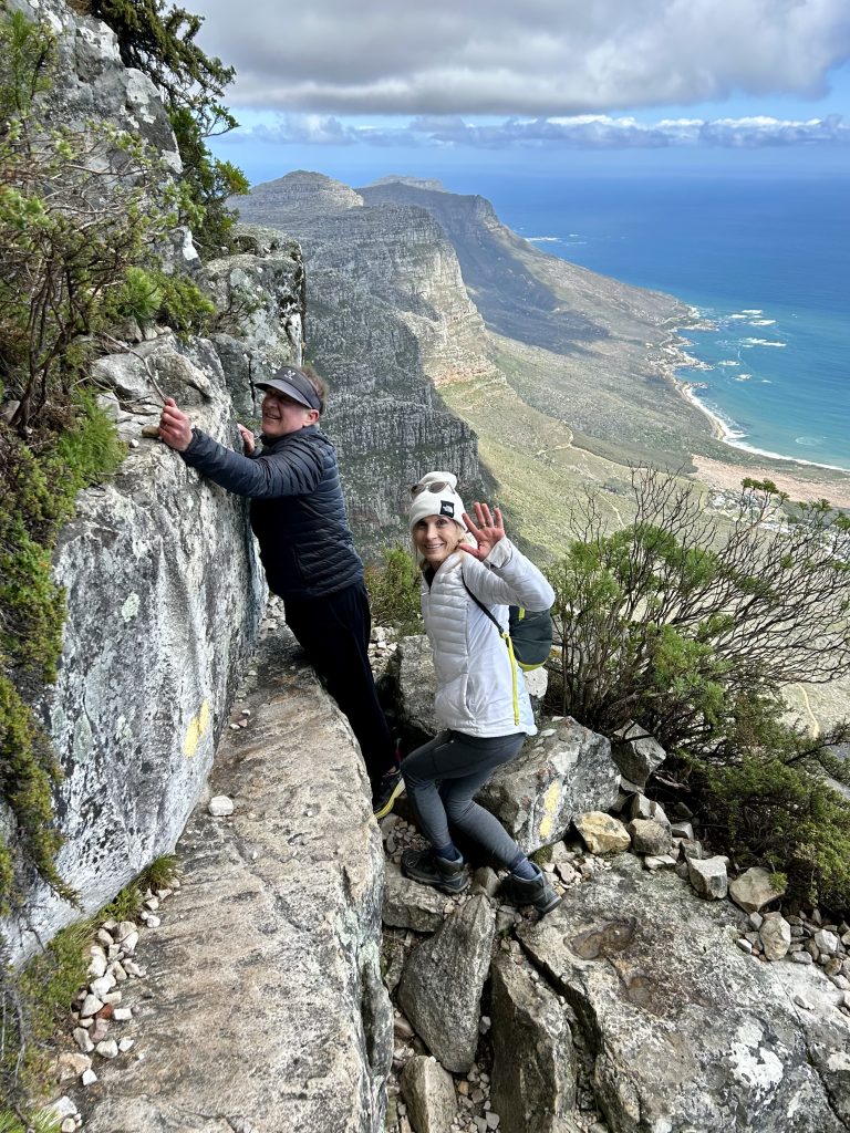
Kasteelspoort offers a quieter and more gradual approach to the top of Table Mountain. It’s less intimidating than India Venster, but longer than Platteklip. The route meanders up stone steps and boulders, passing the iconic “Diving Board” rock outcrop and offering sweeping views over the Atlantic Ocean.
Location: Western face of Table Mountain, overlooking Camps Bay
Distance: ~6.5 km/4 miles return (to the top and back)
Elevation Gain: ~900m/2900ft
Difficulty: Moderate to challenging
Technicality: Moderate with some steep sections
Pros: Beautiful views, a quieter trail and sunrise-friendly (shaded most of the morning).
Cons: Longer total duration, as this route does not offer a cable car return option.
Flora & Fauna: Hike through sun-dappled fynbos slopes with proteas and pincushions, and listen for the call of the Cape robin-chat or spot a klipspringer on the rocks.
Oppelskop
“Panoramic views, small scrambles and historical tales, all in one short hike” – Simon, Private Guide
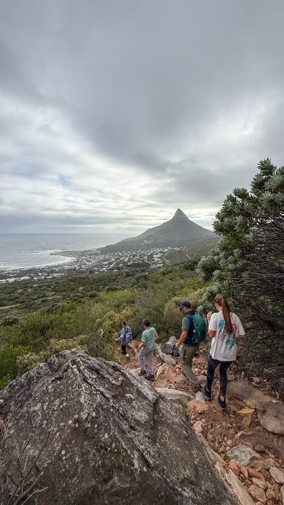
Starting from a discreet trailhead, the Oppelskop route climbs steadily up the eastern shoulder of Table Mountain, offering a less-travelled but rewarding alternative to the more popular ascents on the mountain’s front face. The trail forms part of the Saddle Path network, winding its way past the old WWII blockhouses and eventually cresting at Oppelskop Ridge, a grassy, windswept viewpoint between Devil’s Peak and Table Mountain.
While it lacks the summit payoff of other hikes, the trail offers exceptional 360-degree views, from the city to False Bay on a clear day. It’s a perfect morning or late afternoon hike, especially for those looking to experience Table Mountain’s eastern side without the crowds.
Location: Eastern slopes of Table Mountain
Distance: ~6 km/3.7 miles return
Elevation Gain: ~450m/1400ft
Difficulty: Moderate
Technicality: Low to moderate. A steady incline with uneven stone paths and switchbacks
Pros: Quiet, little-known route, rich historical points, and expansive views.
Cons: Exposed to sun and wind, with limited shade. Some sections may be overgrown.
Flora & Fauna: You’ll hike through robust mountain fynbos. Restios, proteas, and ericas dominate these slopes. The route is also home to numerous sunbirds and occasional raptors. In spring, the flowers are particularly striking, with bursts of colour lining the upper sections of the trail.
Lion’s Head
“Iconic. Best enjoyed with a sunrise, sunset or moonrise” – Kevin, Head Guide
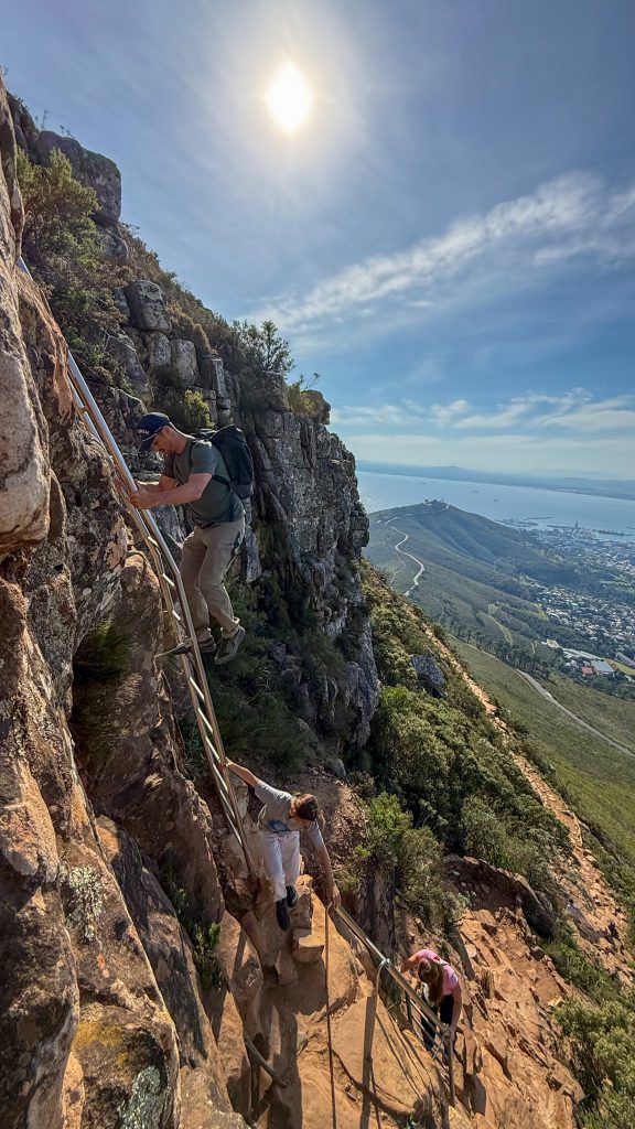
One of Cape Town’s most iconic peaks, Lion’s Head is a spiralling ascent that rewards hikers with a 360-degree panorama at the summit. It’s a popular sunrise and sunset trail, and rightly so. The path gradually circles the mountain, offering alternating views of the city, Atlantic Ocean, and Table Mountain, before reaching steeper sections that require scrambling with the aid of ladders and handholds. Take a slightly longer route to avoid the ladder section around the backside of the summit. Note that this section still involves rocky terrain and light scrambling.
Location: Eastern slopes of Table Mountain
Distance: ~6 km/3.7 miles return
Elevation Gain: ~450m/1400ft
Difficulty: Moderate
Technicality: Low to moderate. A steady incline with uneven stone paths and switchbacks.
Pros: Spectacular views at a manageable distance, great for golden-hour photography.
Cons: Very busy during peak times, with a steep final section that can feel exposed and less than ideal in wet weather.
Flora & Fauna: Cape fynbos is in full display here. Look out for sugarbush proteas, wild rosemary, lizard species basking on rocks, and paragliders soaring overhead.
Lion’s Head Loop
The Lion’s Loop is a scenic and relatively gentle contour trail that circles the base of Lion’s Head. Unlike the summit hike, this route offers a tranquil, less-travelled alternative for those wanting breathtaking views without the steep climb. You’ll pass through patches of pine forest, walk along sandstone paths, and catch views of the long stretch of the Atlantic Seaboard, panoramic views of Table Mountain and the 12 Apostles, the city and the Stellenbosch mountains in the distance.
Location: Base contour path around Lion’s Head
Distance: ~4 km/2.5-mile loop
Elevation Gain: ~150m/500ft
Difficulty: Easy to moderate
Technicality: Low
Pros: Less crowded, suitable for a relaxed hike or trail run and shaded in parts.
Cons: Not as dramatic as the summit trail, with some erosion in wet weather.
Flora & Fauna: A blend of fynbos and alien pine stands, with views over the city and the Atlantic suburbs and oceans. Expect the usual suspects of small wildlife, such as lizards and sunbirds. In spring, wildflowers create pockets of colour along the path.
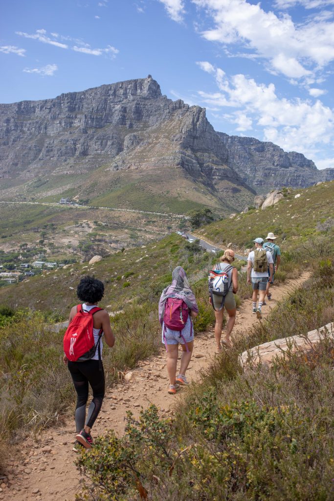
Moving further away from the city, the eastern side of Table Mountain, towards Constantia and the tip of the peninsula, offers a few less-frequented hikes we encourage guests to consider.
Newlands Forest
“A magical, fairy-garden-like sanctuary layered with endless paths, towering trees and waterfalls.” – SJ, Experience Director
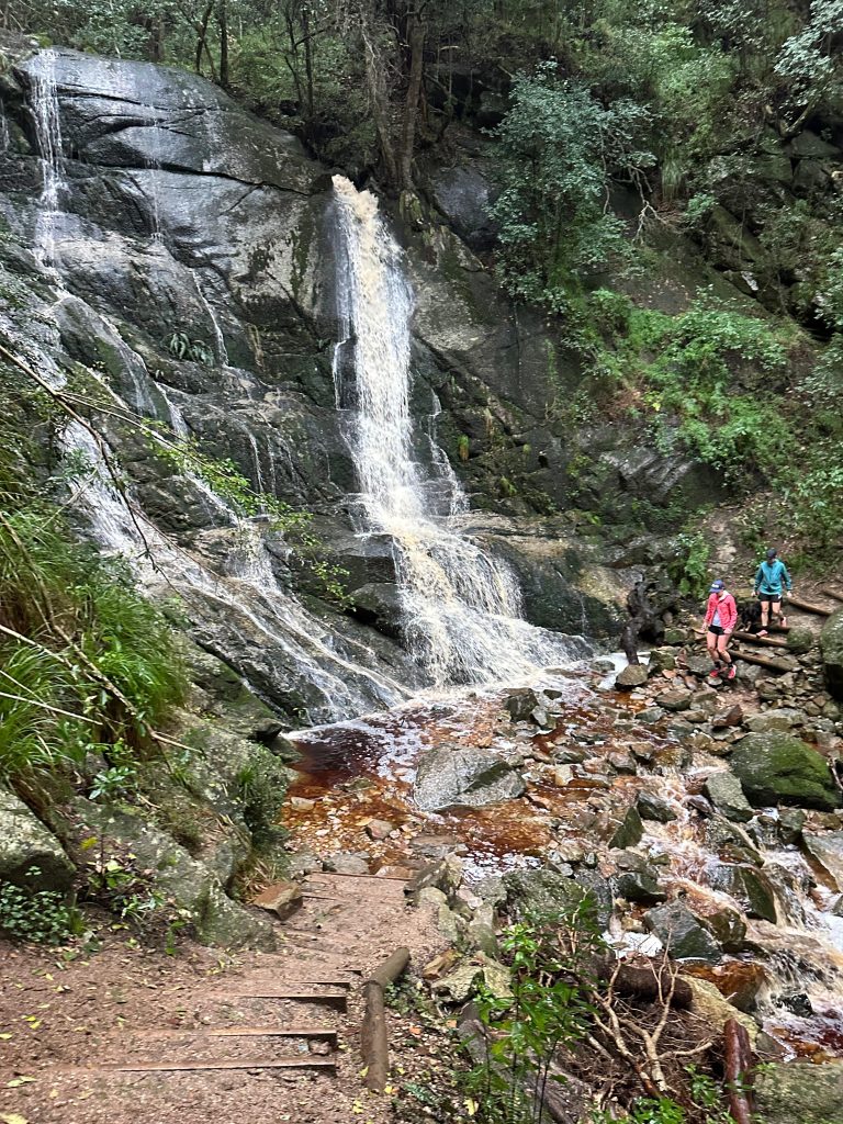
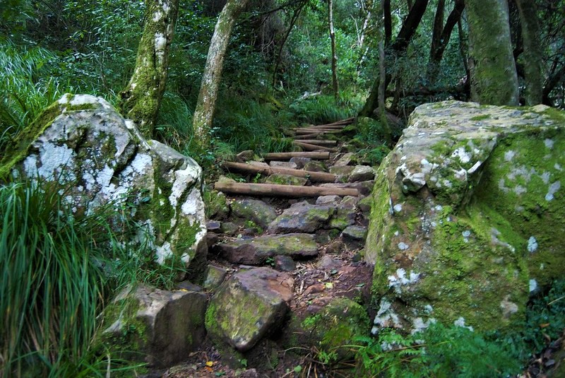
Newlands Forest offers a refreshing contrast to the open, exposed mountain trails that dominate much of Cape Town’s hiking. Tucked beneath the eastern slopes of Table Mountain, this patchwork of indigenous afromontane forest and old pine plantation is cool, shaded, and deeply atmospheric. Trails weave past gurgling streams, mossy tree trunks, and rock pools, making it ideal for early-morning or hot-summer hikes.
Newlands Forest is where locals come to move and breathe. This is not a summit hike, but rather an invitation to immerse yourself in one of the Cape’s most tranquil and biodiverse environments.
Location: Eastern slopes of Table Mountain
Distance: Varied (3–10 km/2-6 mile loops possible)
Elevation Gain: Moderate
Difficulty: Easy to moderate
Technicality: Low
Pros: Shaded, great for hot days and family-friendly options available.
Cons: Can be muddy after rain, with no scenic views unless you hike higher up the slopes
Flora & Fauna: Expect to see yellowwoods, wild olives, tree ferns, and a carpet of forest floor mosses. Birders can look out for Cape batis, Knysna turacos, and forest buzzards. On quiet days, bushbuck or porcupine tracks may be spotted along the paths.
Newlands Forest to Constantia Nek
“A journey through undulating forest and fynbos with magical waterfalls and streams along the way.” – Dan Sheard, Managing Director
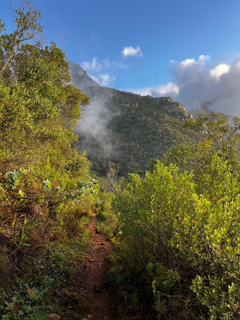
For hikers wanting a fuller journey through the forested folds of the mountain, this traverse connects Newlands to Constantia Nek. It is one of the most scenic and rewarding mid-altitude hikes on Table Mountain. Starting in the lush canopies of Newlands Forest, the trail gradually climbs through shaded woodland before transitioning into fynbos-covered slopes with sweeping views across the Southern Suburbs, False Bay, and the back of Table Mountain.
The route follows a section of the Contour Path, hugging the mountain’s eastern flanks before descending into the terraced slopes of Constantia Nek, a beautiful place to end the journey with a cold drink or a picnic under the trees.
This hike is a fantastic showcase of the mountain’s changing ecology, taking you from dense forest to high mountain vegetation and finally into lower Constantia woodland. It’s also a favourite for those who prefer gradual elevation changes over steep ascents.
Location: Eastern Table Mountain traverse
Distance: ~10 km/6 miles
Elevation Gain: Varied, average of 350m/1100ft
Difficulty: Moderate
Technicality: Moderate, with steps and uneven terrain.
Pros: Rich biodiversity, varied scenery, and good birding.
Cons: Can get overgrown in certain places.
Flora & Fauna: Pass through fynbos-rich ridges with proteas, pincushions, and the occasional Watsonia in bloom. Birdlife is rich throughout. Keep an ear out for the bokmakierie, Cape sugarbird, and spotted eagle owl calls at dusk. On warm days, you might spot a boomslang or Cape mountain lizard basking on the rocks.
Skeleton Gorge
Always a fantastic adventure…for the fit. There’s a timelessness within the surreal world of the kloof and the sneaky swim at Table Mountain’s secret beach” – Dan Sheard, Managing Director
Skeleton Gorge is one of the most dramatic and rewarding ascents of Table Mountain, beginning in the shaded indigenous forest of Kirstenbosch and finishing on the open, wind-swept plateau of Table Mountain. The route follows a steep ravine, crossing streams and moss-covered boulders, and includes several wooden ladders that assist in climbing narrow, often slippery sections.
This is a rainforest-to-mountain-top experience, transitioning from shaded afromontane forest to high-altitude fynbos in just a few hours. For those unfamiliar with Cape Town’s terrain, this hike is a surprise. It’s steep, humid, and technical in parts, but incredibly scenic and satisfying.
Location: Eastern Table Mountain, starting in Kirstenbosch National Botanical Garden
Distance: ~6.5 km/4 miles to the Upper Cable Station (longer if hiking back down)
Elevation Gain: ~900m/2900ft
Difficulty: Challenging
Technicality: Moderate to high. Includes steep inclines, wooden ladders, rock scrambles, and riverbed crossings
Pros: Shaded forest for much of the route, rich biodiversity, and one of the most iconic Table Mountain routes
Cons: Steep and often wet underfoot. Ladders may be intimidating for some.
Flora & Fauna: Starting in the heart of one of the most biodiverse botanical gardens in the world, you’ll pass yellowwoods, tree ferns, and wild olive groves before reaching the fynbos zone with sugarbush proteas and ericas. Look for the Knysna loerie (turaco), forest canaries, and the ever-busy Cape white-eye.
Elsie’s Peak
“Minimal effort for maximum rewarding coastal views.” – Tania, Product & Fulfilment
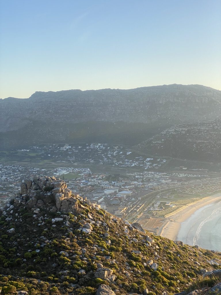
This lesser-known gem further down south is perfect for those seeking a short but rewarding hike. The trail zigzags up from Glencairn to panoramic views over False Bay and Simon’s Town. It’s ideal for sunrise hikes or a quick morning adventure, making it an excellent addition to a day spent exploring the south of the peninsula.
Location: Glencairn (False Bay coast)
Distance: ~3 km/1.8 miles return
Elevation Gain: ~250m/820ft
Difficulty: Easy to moderate
Technicality: Low
spent exploring the south of the peninsula.
Pros: Coastal views, fewer crowds, short and sweet.
Cons: Steep in places with no shade and exposed to wind.
Flora & Fauna: Coastal fynbos including flowering vygies, restios, and Watsonia in season. Birds of prey and Cape grysbok may be spotted by the lucky and quiet.

You may also like
Keep the curiosity alive and embark on a journey of discovery with our handpicked selection of articles.






Start creating your travel experience
We always aim to reply within 24 hours.